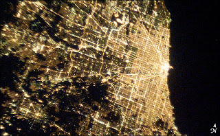
Artificial satellites have a long and interesting history, from ‘Newton’s Cannonball‘ thought experiment, to Arthur C. Clarke‘s prediction of telecommunication satellites in ‘Wireless World’, to Sputnik and the modern day space station. These high-flying gadgets have allowed us to see the world from a different perspective. In particular they have allowed detailed images of our cities and regions to be taken, demonstrating both the advancement of civilisation and the extent of our sprawl.
NASA has compiled a range of images of our cities and regions at night. These were taken on board the International Space Station between 2002 and 2008. Have a look and see how many cities you can recognise from space!
